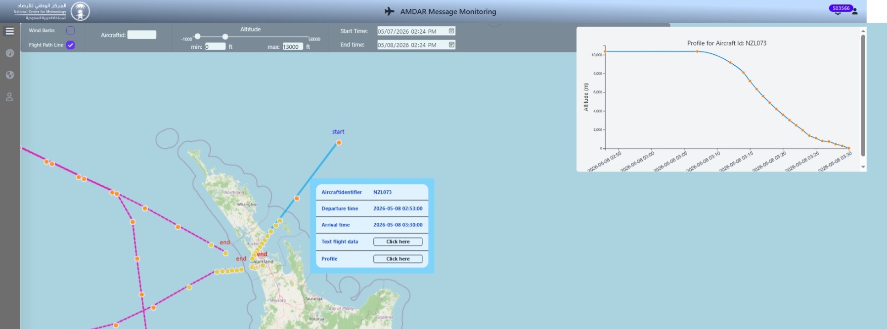
A fully automated Aircraft Meteorological Data Relay system — collecting, processing and distributing high-resolution atmospheric profile data from commercial aircraft directly into NWP models and operational forecasting workflows.
Working with partner Nudhum, IES delivered the AMDAR system for the National Centre for Meteorology (NCM) of Saudi Arabia. The system captures and transmits meteorological data from aircraft platforms — including Saudi Arabian Airlines (Saudia) — encoding it into WMO AMDAR format and WMO BUFR bulletins for NWP model integration and real-time display.
AMDAR provides high-resolution vertical profiles of wind, temperature and humidity across all flight phases — take-off, ascent, cruise and descent — filling critical gaps in the upper-air observation network that radiosondes and satellites alone cannot cover.
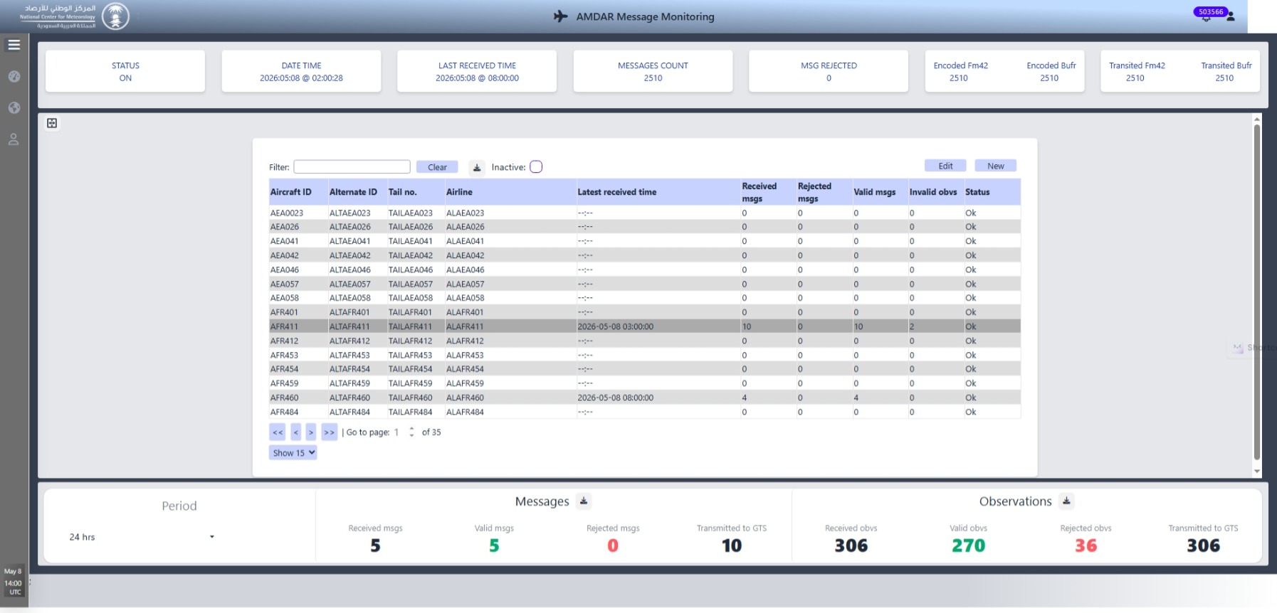
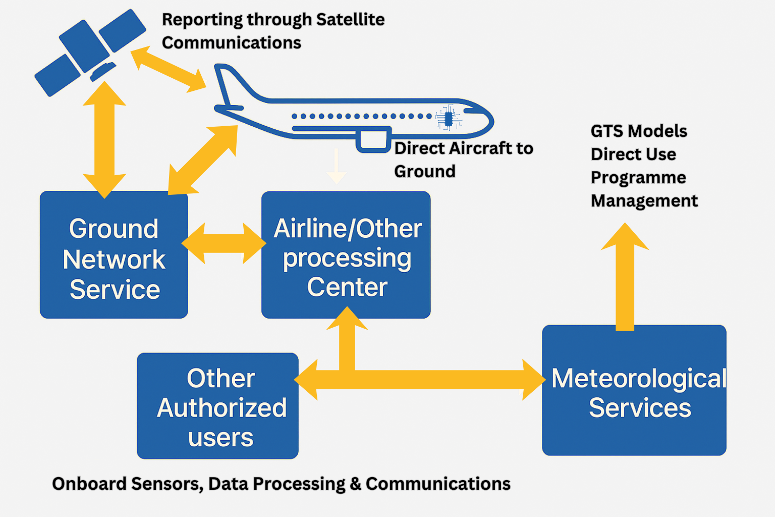
The IES AMDAR System manages the complete observation pipeline — from raw aircraft transmission to operational model ingestion and WebGIS display.
The AMDAR system captures a comprehensive set of meteorological parameters across all phases of flight.
Receives raw ACARS AMDAR messages from multiple airline feeds simultaneously. Compatible with ARINC, SITA and direct airline data streams, handling all message types across take-off, climb, cruise, descent and landing phases.
Automated multi-level QC checks covering range validation, internal consistency, temporal and spatial buddy checks. Suspect reports are flagged and rejected before encoding, protecting NWP model data integrity.
Generates fully compliant WMO BUFR Edition 4 bulletins using current AMDAR BUFR templates. Also produces legacy TAC AMDAR bulletins for backward-compatible distribution — both formats available simultaneously.
Distributes encoded BUFR bulletins to the WMO Global Telecommunication System (GTS), NWP centres and forecast offices via FTP, SFTP and socket channels. Configurable distribution schedules and bulletin intervals.
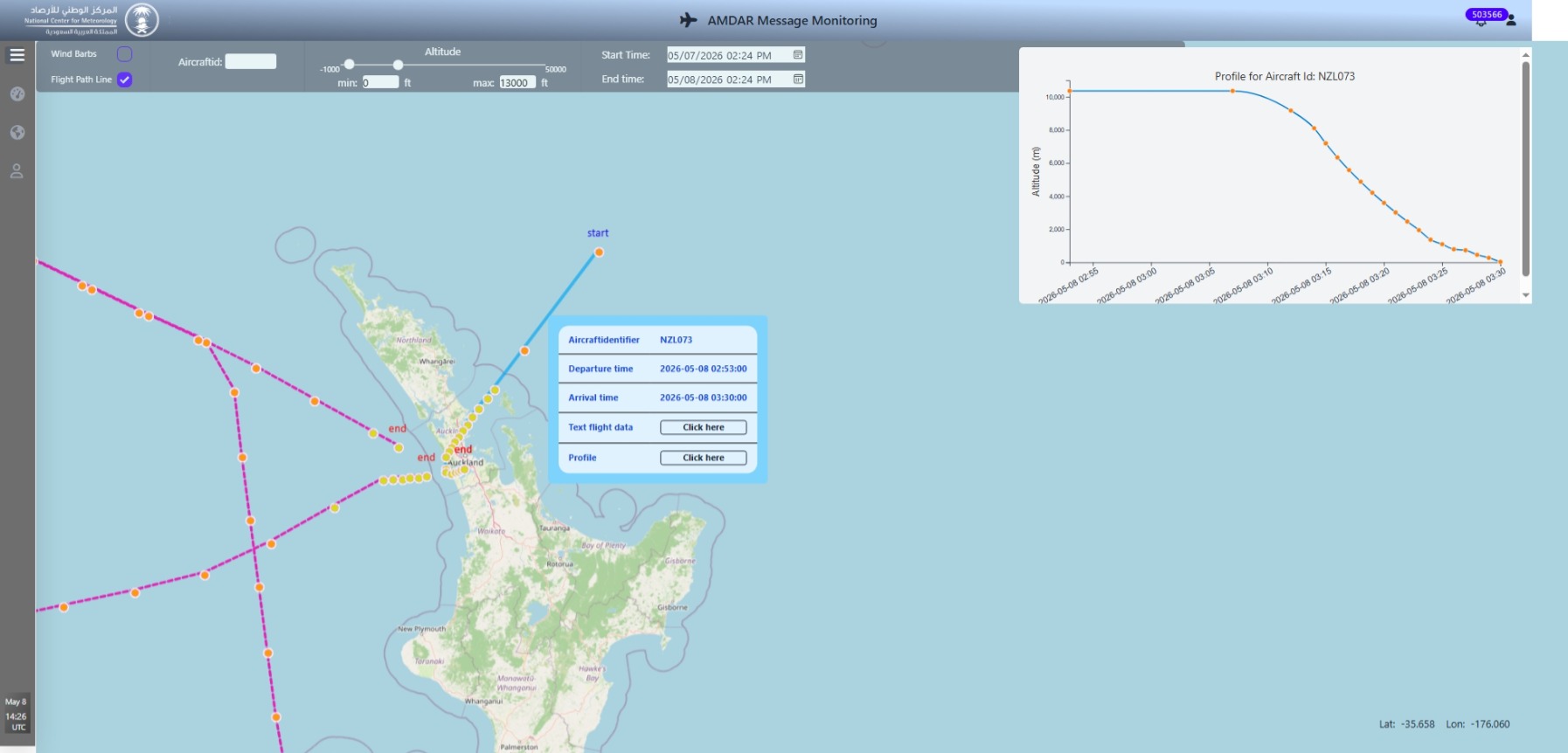
Decoded AMDAR reports ingested directly into IES WebGIS — enabling forecasters to visualize aircraft vertical profiles, aircraft track maps and time-height cross-sections alongside radar, satellite and NWP model data.
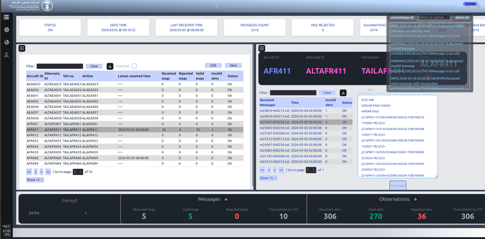
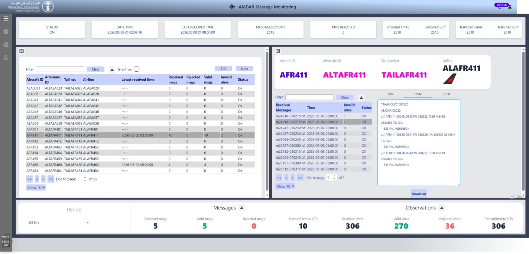
Comprehensive real-time monitoring of all system components — ingest rates, processing throughput, QC statistics, BUFR generation status and distribution confirmations — with automated alerts for any pipeline interruption.
Built around international standards to ensure full interoperability with NWP centres and meteorological networks worldwide.
The IES AMDAR System is delivered as a complete turnkey solution, configurable for national meteorological centres, civil aviation authorities and private operators.
On-premise installation at the national weather service data centre. Full integration with GTS, NWP model input systems and existing operational infrastructure. Includes FAT, SAT and on-site user training.
Co-located deployment at the CAA or ANSP data centre, with direct feeds from airline datalink providers. Data distributed to the national meteorological service and aviation forecast offices.
Fully managed cloud-hosted service. No hardware investment required. Data delivered to the client's NWP systems via secure API and FTP. Monthly subscription model available.
Working with partner Nudhum, IES delivered a complete AMDAR system for the National Centre for Meteorology (NCM) of Saudi Arabia. The system captures and transmits meteorological data from aircraft platforms including Saudi Arabian Airlines (Saudia), encoding observations into WMO AMDAR format and WMO BUFR bulletins for direct NWP model integration and real-time WebGIS display across the kingdom.
The system is designed to scale across all airline fleets operating within a country's airspace — from a single national carrier to the full complement of domestic and international operators — without changes to the core platform architecture.
The AMDAR System feeds directly into the IES WebGIS visualization platform, making aircraft observations available alongside all other meteorological data sources in a single operational environment.
AMDAR observations are decoded and ingested into Met-WebGIS alongside radar, satellite and NWP model data — enabling forecasters to visualize aircraft profiles in full meteorological context on a single platform.
Aircraft vertical profiles rendered in the IES 3DV-Cube module allow forecasters to explore AMDAR soundings in a fully interactive 3D environment alongside NWP model outputs and radar reflectivity.
Aircraft tracks and observation locations visualized on the IES 3D-Globe module — providing an at-a-glance situational view of AMDAR coverage density and recent flight paths across any region.
Contact us to request a live demonstration, technical specifications or deployment information for your national meteorological centre or aviation authority.