Met-WebGIS

IWXXM / WIS 2 Compliant

A web-based meteorology data integration, visualization and forecasting platform — customizable for hydrology, environment and disaster management applications.

About Met-WebGIS

Met-WebGIS

Met-WebGIS is a customized version of the IES WebGIS package, designed specifically for meteorology forecasting services. It provides a complete solution for viewing and manipulating geographic information data for environmental applications, supporting multiple data sources and a wide range of processing and rendering features.

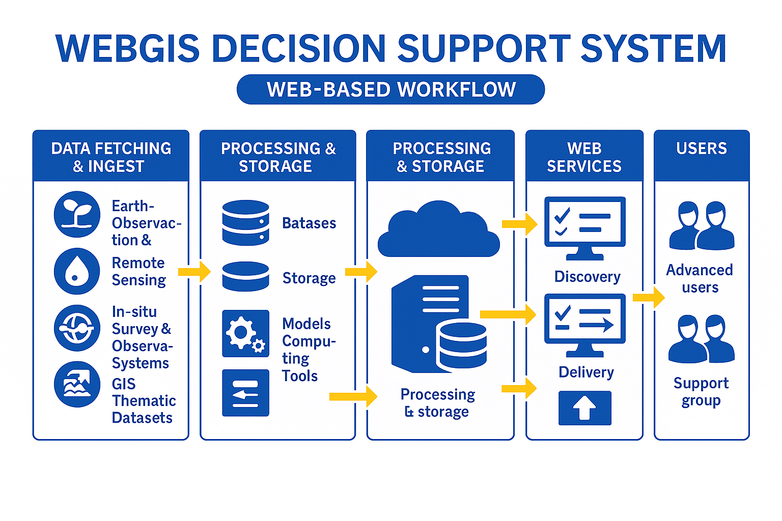
The WebGIS package has the capabilities to be set up as a Decision Support System for applications such as hydro-met events monitoring, disaster management, weather aviation assistance and more. All generated products are web-enabled and accessible via any standard browser over Internet or LAN.

Met-WebGIS System Overview
Platform Capabilities

Functionalities

Data Ingest & Processing

Automatic fetch from appropriate sources at the correct frequency. Pre-processes data into uniform types — points, polylines or images — ready for querying, rendering and distribution.

Rendering & Visualization

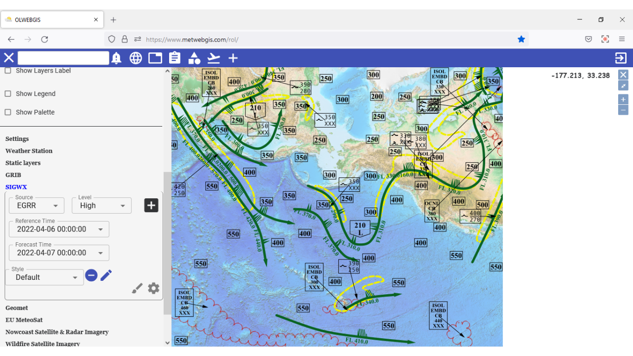
Open-source libraries handling both vector and raster formats. Template & Macros system lets users save customized product layouts and reload or schedule them automatically.

Databasing & Querying

Geospatial database structure for dynamic and static GIS ancillary data. Supports ICAO IWXXM, TAC, XML and GML formats for METAR, SPECI, TAF, SIGMET and AIRMET queries.

Analysis Tools

Compiles relevant data layers into derived products for advanced assessment and decision-making. Supports volcanic ash and tropical cyclone advisories.

Alerts & Warnings

Alarm/Alert system with warning generation and result validation. Pattern matching can be defined and applied to the database to generate automatic warnings.

Web Publishing

All products are web-enabled. Supports publishing and distribution of images, PDF reports, shapefiles and GML with full legends and identification metadata.

Data Sources

Supported Data Inputs

Met-WebGIS integrates data from all major meteorological and environmental data networks simultaneously.

  • Weather Radar Networks
  • Weather Satellites (geostationary & polar orbiting)
  • Numerical Weather Prediction (NWP) Model outputs
  • In-situ Weather Observation Networks
  • Lightning Detection Networks
  • WAFS / SADIS / ISCS sources
  • GIS thematic datasets (DEM, coastlines, lat/long grids)
  • Other client-defined weather data sources
Key Features

Features

A complete feature set for professional meteorological operations and forecasting workflows.

  • Georeferenced display with overlay and style customization
  • Filtering, derived product calculation and multi-panel overlay
  • Time animation of weather products
  • METAR, SPECI, TAF, SIGMET, AIRMET in TAC, XML and GML (ICAO IWXXM)
  • Volcanic ash and tropical cyclone advisory support
  • Template & Macros for scheduled automatic product generation
  • Web publishing and distribution of all product formats
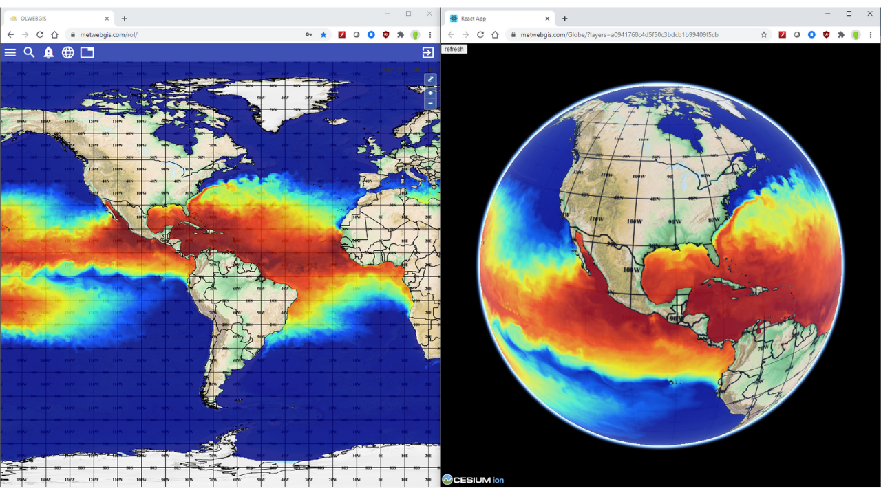
  • 3D-Globe and 3D Volumetric Cube add-ins
  • Chart‑making tools for data visualization.
  • IWXXM / WIS 2.0 standards for next‑generation information services.
WMO Standard

WIS 2.0 Integration

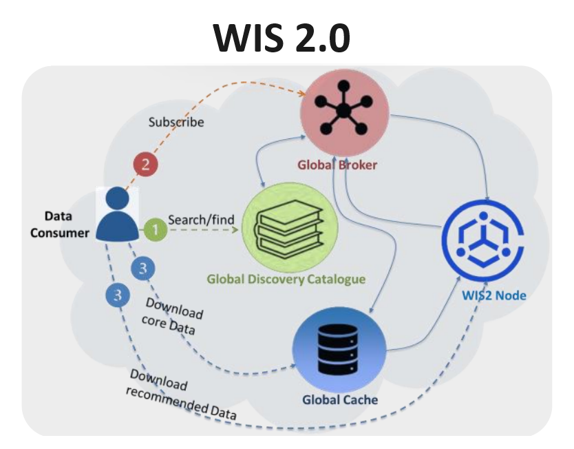
Met-WebGIS provides seamless two-way integration with the WMO Information System 2.0 (WIS 2.0 Box), enabling efficient data exchange and enhanced collaboration within the global meteorological community.
Data Consumption at the Data Consumer Level

Met-WebGIS acts as a WIS 2.0 consumer, allowing users to:

  • Search and discover available datasets
  • Subscribe to relevant data streams
  • Download meteorological data in real time
Data Publication at the WIS 2.0 Node

Met-WebGIS also enables the sharing of locally generated products by:

  • Cataloguing datasets and products within the system

This bidirectional integration ensures that users can both access global meteorological data and contribute their own products through WIS 2.0.

WIS 2.0 Integration Diagram
Domains of Application

Where Met-WebGIS is Used

Met-WebGIS serves any industry that relies on environmental monitoring, weather assessment and decision-support.

Meteorology Hydrology Environment Disaster Management Road & Rail Transport Energy Production Crop Management Pollution Monitoring
Infrastructure

Deployment Options

Dedicated Server

Purchase the system and manage servers locally on your own infrastructure. Full control over data, security and configuration.

SaaS / Cloud

Subscribe to a monthly hosted service in the cloud. No hardware required — access Met-WebGIS from any browser, anywhere.

Interested in Met-WebGIS?

Contact us to request a live demo, trial access or purchase information for your organization.

Back To Top