A large-scale national monitoring and early warning platform — integrating 600 Automated Weather Stations, camera networks and LIDAR sensors to detect, track and alert on sand and dust storm events across Saudi Arabia in real time.
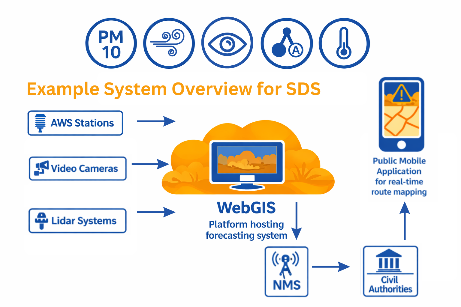
IES software handles data collection, processing and alarm generation — with alerts delivered directly to mobile phones. A dedicated mobile application provides the public with real-time route mapping and dust condition visibility across the kingdom's major highways, enabling drivers, authorities and emergency services to respond rapidly to deteriorating visibility and air quality caused by sand and dust events.
The system integrates hardware from multiple sensor types into a single WebGIS-based operational platform, providing the NCM with complete situational awareness of dust and sand storm events as they develop and move across the country.
Sensor data from 600+ field stations flows through the IES platform — processed, analysed and distributed to operators and the public in real time.
Each station in the network captures a comprehensive set of atmospheric and visibility parameters critical for sand and dust storm detection.
Continuous automated data collection from 600 AWS stations, 600 cameras and 4 LIDAR systems. All sensor data transmitted to a central processing server with configurable acquisition intervals and redundant communications paths.
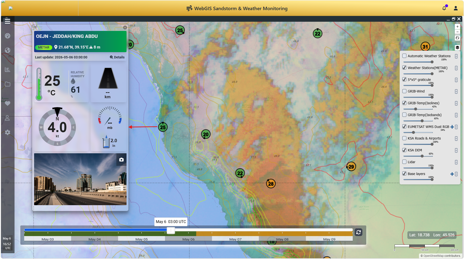
Real-time geospatial display of all sensor observations on the IES WebGIS platform — including station status maps, visibility contours, dust concentration overlays and LIDAR aerosol profiles displayed across the national highway network.
Configurable threshold-based alarm generation for dust concentration, visibility degradation and wind speed exceedances. Alarms delivered directly to NCM operators, civil authorities and the public via the mobile application in real time.
A dedicated mobile app provides the public and transport operators with real-time route mapping and dust condition visibility across major highways. Users receive push alerts for deteriorating conditions along their planned routes.
Four mobile LIDAR systems provide vertical aerosol profiling — detecting the height, density and movement of dust layers. LIDAR data is integrated with AWS observations and camera feeds to provide a complete three-dimensional picture of each event.
600 cameras co-located with AWS stations provide visual confirmation of dust and sand storm events. Camera feeds are integrated into the WebGIS platform, enabling operators to visually verify conditions and assess visibility levels at any station.
The system integrates three complementary sensor technologies to provide comprehensive sand and dust storm monitoring coverage across the kingdom.
This large-scale project is currently underway for the National Centre for Meteorology (NCM) of Saudi Arabia. Upon completion, it will represent one of the most comprehensive sand and dust storm monitoring networks deployed anywhere in the world.
The system directly addresses a critical public safety need in the Arabian Peninsula, where sudden sand and dust storms cause significant disruptions to road transport, aviation and daily life — and can develop rapidly with little warning across vast desert terrain.
The Sand & Dust Storm Warning System is built on the IES WebGIS platform — the same proven technology deployed for national weather services across more than 12 countries.
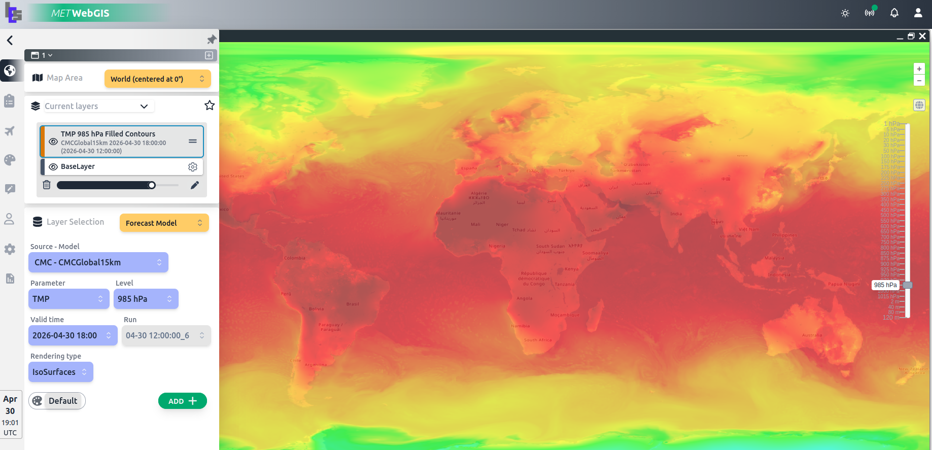
The system is built on Met-WebGIS — providing the data ingest, geospatial rendering, alert management and web publishing capabilities that form the operational backbone of the monitoring platform.
Dust storm event tracks and sensor observation coverage displayed on the IES 3D-Globe — providing operators and NCM forecasters with a broad situational awareness view of developing events across the region.
Alarm outputs from the WebGIS platform feed directly into the public mobile application, providing drivers and citizens with real-time dust condition maps and push notifications for high-risk route segments.
Contact us to learn more about our dust and sand storm monitoring capabilities, or to discuss how IES can design a similar system for your national meteorological service or civil protection agency.